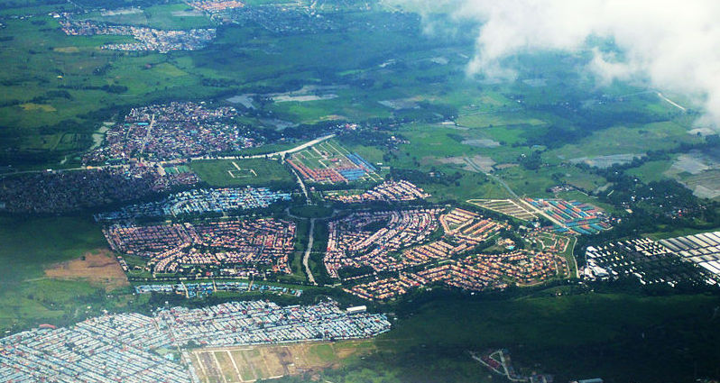
Kategorien in Ternate (Cavite)
Branchen
Unternehmensverteilung nach Branche in Ternate (Cavite)
| Branchenbeschreibung | Anzahl der Betriebe |
|---|---|
| Restaurants | 69 |
| Sonstige Beherbergungsstätten | 21 |
| Cafés | 19 |
| Einkaufen | 17 |
| Kirchen | 15 |
| Erziehung und Unterricht | 12 |
| Religion | 12 |
| Lebensmittelläden und Supermärkte | 9 |
| Reise und Transport | 9 |
| Öffentliche Verwaltung | 8 |
Ternate (Cavite) Facts
| Gebiet | 35.4 km² |
| Bevölkerung | 16.652 |
| Männliche Bevölkerung | 8.430 (50.6%) |
| Weibliche Bevölkerung | 8.222 (49.4%) |
| Population change (1975 to 2020) | +27.5% |
| Population change (2000 to 2020) | -16.9% |
| Mittleres Alter | 23 years (Male: 22.8, Female: 23.2) |
| Stadtviertel | Sapang, Barangay 3, Poblacion, San Jose, Guadalupe Nuevo, Ternate Residential Estate |
| Zeit vor Ort | |
| Zeitzone | Philippinische Normalzeit |
| Geogr. Länge & Breite | 14.28970, 120.71680 |
| Postleitzahlen | 4111 |
Karte von Ternate (Cavite)
Interaktive Karte
Bevölkerung von Ternate (Cavite)
Jahre 1975 bis 2020
| Data | 1975 | 1990 | 2000 | 2015 | 2020 |
|---|---|---|---|---|---|
| Bevölkerung | 13.060 | 19.933 | 20.028 | 15.559 | 16.652 |
| Bevölkerungsdichte | 368,5 / km² | 562,5 / km² | 565,2 / km² | 439,1 / km² | 469,9 / km² |
Bevölkerungsänderung in Ternate (Cavite) von 2000 bis 2015
Rückgang um 22.3 % von 2000 bis 2015
| Standort | Änderung seit 1975 | Änderung seit 1990 | Änderung seit 2000 |
|---|---|---|---|
| Ternate (Cavite) | +19.1% | -21.9% | -22.3% |
| Philippinen | +146.5% | +63.3% | +29.5% |
Medianalter von Ternate (Cavite)
Medianalter: 23 Jahre
| Standort | Mittleres Alter | Durchschnittsalter (weiblich) | Durchschnittsalter (männlich) |
|---|---|---|---|
| Ternate (Cavite) | 23 yrs | 23.2 yrs | 22.8 yrs |
| Philippinen | 23.2 yrs | 23.6 yrs | 22.8 yrs |
Bevölkerungsdichte von Ternate (Cavite)
Bevölkerungsdichte: 470 / km²
| Standort | Bevölkerung | Gebiet | Dichte |
|---|---|---|---|
| Ternate (Cavite) | 16.652 | 35,4 km² | 470 / km² |
| Philippinen | 96,6 million | 296.939,4 km² | 325 / km² |
Historische und prognostizierte Bevölkerung von Ternate (Cavite)
Geschätzte Bevölkerung von 1200 bis 2100
- JRC (Gemeinsame Forschungsstelle der Europäischen Kommission) arbeitet an GHS built-up grid
- CIESIN (Center for International Earth Science Information Network)
- [Verknüpfung] Klein Goldewijk, K., Beusen, A., Doelman, J., and Stehfest, E.: Anthropogenic land use estimates for the Holocene – HYDE 3.2, Earth Syst. Sci. Data, 9, 927–953, https://doi.org/10.5194/essd-9-927-2017, 2017.
Vorwahlen
Prozentuale Vorwahlen, die von Unternehmen in Ternate (Cavite) verwendet werden
Human Development Index (HDI)
Statistischer zusammengesetzter Index der Lebenserwartung, der Bildung und des Pro-Kopf-Einkommens.
CO2-Emissionen von Ternate (Cavite)
Kohlendioxid (CO2) -Emissionen pro Kopf in Tonnen pro Jahr
| Standort | CO2-Emissionen | CO2-Emissionen pro Kopf | Intensität der CO2-Emissionen |
|---|---|---|---|
| Ternate (Cavite) | 17,678 tn | 1.06 tn | 498.8 tons/km² |
| Philippinen | 104,920,564 tn | 1.09 tn | 353.3 tons/km² |
| CO2-Emissionen 2013 (Tonnen/Jahr) | 17,678 tn |
| CO2-Emissionen 2013 (Tonnen/Jahr) pro Kopf | 1.06 tn |
| CO2-Emissionsintensität 2013 (Tonnen/km²/Jahr) | 498.8 tons/km² |
Naturgefahrenrisiko
Relatives Risiko von 10
| Gefahr | Risikostufe |
|---|---|
| Dürre | Mittel (4) |
| Flut | Hoch (10) |
| Erdbeben | Mittel (7) |
| Zyklon | Hoch (10) |
| Erdrutsch | Hoch (8) |
| Vulkan | Hoch (9) |
* Das Risiko, insbesondere in Bezug auf Überschwemmungen oder Erdrutsche, gilt möglicherweise nicht für das gesamte Gebiet.
- Dilley, M., R.S. Chen, U. Deichmann, A.L. Lerner-Lam, M. Arnold, J. Agwe, P. Buys, O. Kjekstad, B. Lyon, and G. Yetman. 2005. Natural Disaster Hotspots: A Global Risk Analysis. Washington, D.C.: World Bank. https://doi.org/10.1596/0-8213-5930-4.
- Center for Hazards and Risk Research - CHRR - Columbia University, Center for International Earth Science Information Network - CIESIN - Columbia University, and Norwegian Geotechnical Institute - NGI. 2005. Global Landslide Hazard Distribution. Palisades, NY: NASA Socioeconomic Data and Applications Center (SEDAC). https://doi.org/10.7927/H4P848VZ.
- Center for Hazards and Risk Research - CHRR - Columbia University, Center for International Earth Science Information Network - CIESIN - Columbia University, International Bank for Reconstruction and Development - The World Bank, and United Nations Environment Programme Global Resource Information Database Geneva - UNEP/GRID-Geneva. 2005. Global Cyclone Hazard Frequency and Distribution. Palisades, NY: NASA Socioeconomic Data and Applications Center (SEDAC). https://doi.org/10.7927/H4CZ353K.
- Center for Hazards and Risk Research - CHRR - Columbia University, Center for International Earth Science Information Network - CIESIN - Columbia University, and International Research Institute for Climate and Society - IRI - Columbia University. 2005. Global Drought Hazard Frequency and Distribution. Palisades, NY: NASA Socioeconomic Data and Applications Center (SEDAC). https://doi.org/10.7927/H4VX0DFT.
- Center for Hazards and Risk Research - CHRR - Columbia University, Center for International Earth Science Information Network - CIESIN - Columbia University. 2005. Global Flood Hazard Frequency and Distribution. Palisades, NY: NASA Socioeconomic Data and Applications Center (SEDAC). https://doi.org/10.7927/H4668B3D.
- Center for Hazards and Risk Research - CHRR - Columbia University, Center for International Earth Science Information Network - CIESIN - Columbia University. 2005. Global Volcano Hazard Frequency and Distribution. Palisades, NY: NASA Socioeconomic Data and Applications Center (SEDAC). https://doi.org/10.7927/H4BR8Q45.
- Center for Hazards and Risk Research - CHRR - Columbia University, Center for International Earth Science Information Network - CIESIN - Columbia University. 2005. Global Earthquake Hazard Distribution - Peak Ground Acceleration. Palisades, NY: NASA Socioeconomic Data and Applications Center (SEDAC). https://doi.org/10.7927/H4BZ63ZS.
Aktuelle Erdbeben in der Nähe
Magnitude 3.0 und höher
| Datum▼ | Zeit↕ | Magnitude↕ | Distance↕ | Tiefe↕ | Standort↕ | Verknüpfung |
|---|---|---|---|---|---|---|
| 6/10/19 | 11:03 PM | 4.2 | 9.8 km | 185,490 m | 4km NNE of Naic, Philippines | usgs.gov |
| 3/11/19 | 8:11 PM | 4.2 | 29.7 km | 160,580 m | 3km SSW of Luksuhin, Philippines | usgs.gov |
| 10/20/18 | 3:06 PM | 4.4 | 29.3 km | 208,950 m | 4km ENE of Bolboc, Philippines | usgs.gov |
| 7/3/18 | 4:25 AM | 5.2 | 31 km | 126,000 m | 2km SSW of Lian, Philippines | usgs.gov |
| 5/14/18 | 3:14 AM | 4.2 | 30.4 km | 116,110 m | 2km SE of Lian, Philippines | usgs.gov |
| 10/22/17 | 2:21 PM | 5.4 | 32 km | 209,390 m | 0km NNW of Putol, Philippines | usgs.gov |
| 8/15/17 | 10:04 AM | 4.2 | 38.6 km | 104,850 m | 1km ENE of Balayan, Philippines | usgs.gov |
| 8/12/17 | 5:51 PM | 4.8 | 36.6 km | 193,990 m | 2km NNE of Bungahan, Philippines | usgs.gov |
| 8/11/17 | 5:28 AM | 6.2 | 31.4 km | 172,000 m | 1km SE of Tuy, Philippines | usgs.gov |
| 2/8/17 | 8:54 PM | 4.3 | 38.8 km | 147,350 m | 3km SW of Payapa, Philippines | usgs.gov |
Ternate (Cavite)
Ternate (Filipino: Bayan ng Ternate) ist eine Stadtgemeinde in der philippinischen Provinz Cavite.
Ternate (Cavite) Wikipedia-Seite")


Über unsere Daten
Die Daten auf dieser Seite werden anhand verschiedener öffentlich zugänglicher Werkzeuge und Quellen geschätzt. Sie werden ohne Gewähr bereitgestellt und können Ungenauigkeiten enthalten. Nutzung auf eigene Gefahr.